Urban Land Institute
Close

Aurora Bioswales

Context

The Aurora Bridge is an essential piece of Seattle’s transportation infrastructure and carries more than 65,000 vehicles through the city per day. During the city’s frequent rainstorms, chemicals from the roadway are cast into the waters of the Lake Washington Ship Canal below. This untreated runoff—which researchers say is six times more toxic than the national standard—flows directly into local waterways, harming the health of local ecosystems, economies, and communities.   

As climate change increases the severity of Seattle’s rainstorms, the volume of stormwater runoff is expected to grow. According to research commissioned by Seattle Public Utilities (SPU), extreme rainstorms have become 30 percent stronger since 2003 and are projected to intensify over the coming decades. Heavy rainstorms are already overwhelming the sewer system’s capacity in many neighborhoods, triggering flooding and toxic overflow into local waters.  

Developers Mark Grey, Joanna Callahan, and Mike Hess of Hess Callahan Grey Group (HCG) were inspired to do their part after learning how polluted stormwater affects local wildlife. They had watched a video of baby salmon dying when put directly into water runoff from a nearby bridge. The video then showed the runoff being filtered through soil before introducing the fish, resulting in none of the fish dying. The video demonstrated the power of natural systems to mitigate the effects of toxic stormwater.  

This knowledge led HCG to partner with Salmon Safe, a local organization working to protect waterways, to integrate green infrastructure into two commercial office projects they were developing on a steep slope under Aurora Bridge. Given the unique location, the project team saw an opportunity to collect and treat the bridge’s runoff while improving the adjacent rights-of-way along Troll Avenue, directly underneath the bridge. Dark and unwelcoming, these overlooked tracts of land were mostly empty except for the streams of polluted water that were spilling out of downspouts from the bridge above. 

The team installed the bioswales in three phases. The first two phases, which line Troll Avenue, were financed and permitted as part of the two office projects’ frontage improvements. The third phase, which sits down the hill and closer to the lake, was developed thanks to a nonprofit, Clean Lake Union, formed by Mark to advocate for continued clean-up efforts around the lake. Many public and private partners also contributed to the third phase, including Salmon Safe, The Nature Conservancy, Boeing, Tableau, Adobe, Seattle Public Utilities, and the state of Washington. Together, these three phases collect and treat up to two million gallons of water annually from the entire north span of the Aurora Bridge, minimizing the risk of neighborhood flooding and improving water quality.  

HCG worked with project architect Weber Thompson and engineering firms KPFF and DCI Engineers to bring the swales to life. “The most exciting thing about this project,” says Rachael Meyer, landscape architecture principal and director of sustainability at Weber Thompson, “is that it has convinced so many people that green infrastructure is a viable solution, and it has paved the way for future projects of this kind to be developed throughout the region.”  

Climate Resilience and Sustainability Strategies

Bioswales and natural stormwater management 

The bioswales harness the power of nature to help collect, filter, and absorb stormwater before it is discharged into the lake. Six downspouts located under the Aurora Bridge carry runoff from the roadway into planted areas. The runoff flows through the swales before being returned to the municipal storm drainage system that discharges into Lake Union.  

The swales in the first two phases, located on either side of Troll Avenue North, are terraced and step down every two feet of grade. At each stage, low dams made of Corten steel hold and slow the movement of water so that sediment and contaminants can be filtered into the soil, while the clean surface water outfalls to the next retention cell. The second phase also features staggered concrete walls, which help slow runoff from the adjacent building and promote evaporation. A block downhill, phase 3 is characterized by a spillway and five low steel walls to settle and divert incoming water before it reaches the lake.  

Testing of the water entering and leaving the swales confirmed measurable filtration of a large range of contaminants.  

The design incorporates consecutive swales down the steep hillside of Troll Avenue. As water flows through the swales, sediment in the runoff settles into the soil and the cleaned water at the top of the pool flows to the next stage. Image credit: Built Work Photography

Native Plants and Biodiversity

All three phases incorporate a variety of native plants and trees that provide both an aesthetic landscape and play an important role in stormwater management. Vegetation slows down the movement of water and filters sediment and other large particles. Plants also support healthy soils, which contain microbes that digest contaminants and other tiny particles. 

The project team prioritized pollinator habitat by including flowering plants and designing flat areas within the swales where bees can find water and shady respite in the summer months. Native vine maples, which are often found in the understory of Pacific Northwest forests, add shade in the summer months and color in the fall.  

Most critically, water that has made its way through the swales is visibly cleaner, promoting the health and longevity of five different species of migrating salmon that travel through Lake Union on their way to rivers and streams for spawning. Salmon are foundational to the region’s natural environment, fishing industry, and the cultural identity of local Native American tribes. As indicator species, they provide a signal of the overall health of the Pacific Northwest marine environment.    

Native shrubs and Vine Maples serve as understory plantings to provide a robust forest floor below the overhead canopy that the bridge structure and columns simulate. Image credit: Built Work Photography

Green space and public access 

Through the addition of native plants and natural features, the swales have enhanced two rights-of-way on Troll Avenue North as well as a previously grass-covered tract of land closer to Lake Union. Prior to the swales’ development, these areas were dark and forgotten, always in the shadow of Aurora Bridge above. Today, the swales open up the streetscape and provide a new place for the community to congregate in formerly degraded areas.   

Educational signage in the first two phases engages visitors with the story of the swales and the importance of water quality on the region’s salmon species. Phase 1 also has embedded brass numbers in the sidewalk that show visitors the volume of water cleaned annually in the adjacent swale cell. The steel weirs in the third phase feature silhouette cutouts of the five species of salmon that reside in the nearby waterways.  

The swales are centrally located in the heart of the Fremont neighborhood, known for its quirky shops, unique restaurants, and the iconic Fremont Troll, an 18-foot cement art piece that has lived under the Aurora Bridge since the early 1990s. Down the hill, next to the phase 3 swale, is the Burke-Gilman Trail, which serves more than one million pedestrians and bicyclists annually. Throughout the year, thousands of people travel beside the swales on the Burke-Gilman, on the way up to the Troll, or down to the waters of Lake Union.  

Value Proposition

Added amenity

The bioswales transform previously dark, vacant areas into well-lit, landscaped destinations that people are eager to visit and enjoy. Lined with native plants, the meandering pathways, plazas, and benches invite visitors to gather, take photos, and spend time observing the natural flow of water through the swales. “People stop and appreciate the bioswales even without really knowing what the system is doing to protect the neighborhood and improve water quality,” said Meyer.  

Reduced maintenance costs

Prior to the swales, the area that is now phase 3 was covered in grass, requiring regular mowing and upkeep. Today, minimal maintenance is needed beyond an occasional weeding. In addition, nearby property owners have reported reduced instances of vandalism since the swales were installed, reducing the need for frequent repairs and upkeep.  

Awards and recognition

The bioswales have been recognized by numerous organizations for their unique design and success delivering environmental benefit through a unique public/private partnership.  

  • ULI Global Award for Excellence Winner, 2023 
  • ULI Americas Award for Excellence Winner, 2023 
  • 2022 GRAY Magazine Awards, Grand Winner: Landscape Design 
  • 2022 Gold Nugget Awards, Merit Award: Best Landscape Architecture for a Community 
  • 2022 WASLA Awards, Honor Awards: General Design, Private Ownership 
  • 2019 King County Green Globe Award: Leader in Water Quality Solutions 
  • 2018 WASLA Awards, Phase 1: Vision Award for Water 
  • A case study of this project is included in a United Nations Guide for Sustainable Practices to teach professional designers ways to include green infrastructure as a standard practice.  

Staggered concrete walls help slow runoff and promote evaporation, reducing the amount of water flowing into the swale. Image credit: Built Work Photography

 Lessons Learned

  • This project demonstrates how privately funded green infrastructure can be leveraged to improve public roadways, especially bridges, and provide community benefit. Prior to the Aurora Bridge swales, few precedents existed for private developments electing to clean roadway runoff as part of frontage improvements. This type of development was not originally allowed outright in the city’s code but has now paved the way for more streamlined permitting of future swales across the city. In addition, the success of the Aurora Bridge swales has inspired Seattle Public Utilities to establish programs to incentivize similar improvements as partnerships with private developments.  
  •  The project team has observed that the bioswales are dry most of the time, indicating that less space is needed to collect and filter the bridge’s runoff. This means that the system’s capacity can keep pace as Seattle’s rainstorms become heavier and more severe. Climate predictions for the Seattle area indicate that extreme precipitation events are likely to be more intense. For example, the magnitude of the average 25-year storm is expected to increase by 13 percent by 2050 and 12 percent by 2090.
  • The bioswales offer a replicable model for other communities looking to leverage green infrastructure to improve stormwater management and water quality in urban settings. The regulatory environment around stormwater management is complex, and the team had to navigate numerous requirements from various public agencies at the city, state, and federal level. In particular, the project had to secure special approval to divert roadway catch basins and downspouts into the rightofway temporarily before returning the water to the storm drain system. Despite these hurdles, the success of the bioswales demonstrate the importance of collaboration among these agencies to realize significant community and environmental benefit.  

Babcock Ranch

Thank you to Alex Wilson and the Resilient Design Institute (RDI) for permitting a reprint of the article “Babcock Ranch – A Solar Town Proves Resilient During Hurricane Ian,” which was incorporated as the Context and Climate Resilience Strategies sections of this project profile.

Context

Babcock Ranch was a 91,000-acre (143 sq mi) property in southwest Florida when it was acquired by Kitson & Partners in a complex real estate transaction in which 80 percent of the land was immediately sold to the state of Florida. The property is named after Edward Vose Babcock, a past mayor of Pittsburgh, Pennsylvania, who purchased the land in 1914.

The private development company, Kitson & Partners, founded by the former professional football player Syd Kitson, stepped in and purchased the entire property in 2006, then immediately sold roughly 73,000 acres of the land to the state, with some of the funding from Lee County, to create the Babcock Ranch Preserve, which continues ranching operations that support the maintenance costs of the preserve. The remainder of the land is being developed in an environmentally responsible manner.

“Developers have an impact on the environment, and we need to mitigate those impacts,” Kitson told RDI. “What I set out to prove is that building a new town—a new city—can work hand-in-hand with the environment. I think we’re doing just that.”

Kitson & Partners, with input from public planning meetings held in 2006 as well as outside experts including the Rocky Mountain Institute, developed an environmentally sensitive master plan with a high-tech commercial center that would include an R&D hub for clean energy development, four villages and five hamlets that would ultimately comprise nearly 20,000 homes and 6 million square feet of commercial space—all powered by solar energy. Under the plan, roughly two-thirds of the remaining property would be permanently set aside as open space.

Approximately 2,000 dwelling units have now been completed at Babcock Ranch, with hundreds more under construction. Most are single-family homes, but some are attached villas, townhouses, condominiums, and apartments, according to Jennifer Languell, PhD, who has served as the green building and sustainable development adviser through her company Trifecta Construction.

Climate Resilience and Sustainability Strategies

Site design and wetland engineering

Several factors contributed to Babcock Ranch’s performance during Hurricane Ian. For starters, most of the land is about 30 feet above sea level—veritable highlands for South Florida!

As promised, nearly 12,000 acres of the 18,000 that Kitson & Partners retained has been permanently protected as wetlands, uplands, greenways, and preserves. “Our water management plan is one that uses the natural flow-ways within the community versus clearcutting and forcing the water to go where it doesn’t want to go,” Kitson explained. “We went back and looked at maps a hundred years old and found the natural flow-ways.”

Wetlands and lakes are integral components of the stormwater management system at Babcock Ranch. Photo: Kitson & Partners, courtesy of Alex Wilson/Resilient Design Institute and Lisa Hall.

The wetlands were designed to mimic natural flows and provide natural stormwater management, according to civil engineer Amy Wicks, P.E., the engineer of record for Babcock Ranch Community and vice president of Kimley-Horn, which provided surface water management design, master planning, landscape architecture, roadway design, water and wastewater engineering, and permitting services for Babcock Ranch.

“The water management system is a multifaceted design that utilizes a natural systems approach, coupled with redundancy to protect infrastructure,” noted Wicks. “While the system internal to Babcock Ranch starts with a series of rain gardens that ultimately lead to lakes for stormwater attenuation (detention), these systems then utilize a series of created wetlands and natural flow-ways for storage, similar to how natural wetlands act as storage during large storm events naturally.”

During extreme events, such as hurricanes, this distributed approach is highly advantageous, because it prevents blockages of culverts from causing flooding. “By having a system that operates both in series and in parallel, the system will flow a different direction with little effort,” she explained, “allowing it to function normally, even with blockages.”

Natural landscaping requirements

For a planned community in Florida, Babcock Range mandates native landscaping and minimal chemical treatments. “In common areas, Babcock requires 90 percent native vegetation, and for the homesites, 75 percent must be native,” said Languell.

A commercial center at Babcock Ranch with native landscaping that is resilient to storms. Most commercial buildings have solar modules on the roof. Photo: Kitson & Partners, courtesy of Alex Wilson/Resilient Design Institute and Lisa Hall.

“We require native plant materials here,” said Kitson. “We decided that we were going to go for something authentic. What did Florida look like 100 or 200 years ago? There’s a reason those native plant materials do very well in hurricanes and dry seasons and wet seasons—they’re accustomed to it.” Kitson, who doesn’t have any lawn area at his own Babcock Ranch home, described the native landscaping as beautiful. “I think if you drove through Babcock Ranch, you would notice almost immediately that this area is different.”

Yards at Babcock Ranch can only be 30 percent grass. Lawns are restricted, explained Kitson, because they don’t want the chemicals—including phosphates and nitrates—contaminating their surface waters. “Our lakes are crystal clear because of the limerock, and we don’t want to do anything that disrupts that,” he said. “There are no algae blooms here.”

High-performance, hardened buildings

All buildings at Babcock Ranch must be certified by the Florida Green Building Coalition’s Green Home or Commercial standards, which Languell described as similar to the U.S. Green Building Council’s Leadership in Energy and Environmental Design (LEED) rating, but specifically designed for hot-humid climates. She noted that this is “the only certification program that contains a disaster mitigation section.” Under the building code, “homes are required to be designed to 160-mph wind loads,” said Languell.

Buildings are designed to the Florida Green Building Coalition’s Green Home or Commercial standards, which can include wind-resistant concrete construction. Photo: Alex Wilson/Resilient Design Institute.

Hip roofs are used on most single-family homes to protect against high wind, because of the better performance in high wind than gable roofs. Hurricane strapping, continuous structural connections between foundation and roof framing, and other structural requirements are rigorous—as mandated by the Florida Building Code, which Kitson credits with dramatic improvements in how well newer homes perform throughout Florida. Homebuilders who build at Babcock Ranch also have to either install hurricane-rated windows or supply homeowners with removable hurricane shutters.

Buildings, mostly built of concrete masonry units, are heavily reinforced with rebar and concrete-filled cores for strength.

Many homes include strong metal roofs for wind and debris impacts, and pervious pavers for stormwater management. Photo: Alex Wilson/Resilient Design Institute.

The average Home Energy Rating Score (HERS) for homes at Babcock Ranch is 58—which Languell said is “25 percent more efficient than the Florida Energy Code, which is fairly stringent.” Electric heat pumps are used for all heating and cooling, though natural gas is used in some houses for cooking and water heating.

Both indoor and outdoor water conservation is a community focus, according to Languell. “All plumbing fixtures must be at a minimum WaterSense, but we find that most builders are doing better than the minimum WaterSense conservation levels.”

Site elevation and protection strategies

All homes at Babcock Ranch are built “1 foot above the flood elevation of a 25-year event followed by a 100-year event,” according to Wicks. This standard was adopted to address the increased flood vulnerability when soils are already saturated from prior precipitation, and it equates to about 11 inches of rain followed by 14 inches of rain (25 inches total), she told RDI.

There are no basements to flood, because all buildings are slab-on-grade (which is standard practice for much of Florida). Fill dirt from creating the lakes was used to elevate house sites on the building lots.

Specialized floodproofing measures, such as flood vents and use of wettable materials (materials that can get wet and dry out without growing mold), are not required at Babcock Ranch, according to Wicks, “because we do not anticipate any flooding events.” She explained that “because of the extra precautions taken in the design of the elevations and the stormwater management system, floodproofing of the buildings is not necessary.”

Resilience also involves protection from winds. “All utilities are underground,” said Kitson. The Babcock Ranch–owned water, wastewater, and reclaimed water pipes were colocated with conduit for electricity and data utilities. With all utilities buried, risk of damage from storms is all but eliminated.

A solar city

Babcock Ranch bills itself as “America’s first solar city.” As part of the development plan, Florida Power & Light (FPL) operates two solar farms that generate 150 megawatts on 840 acres of Babcock Ranch. The FPL arrays produce enough electricity to power 30,000 homes—more than will exist at Babcock Ranch at buildout. The rest of the power is fed into the FPL grid.

The two 75-megawatt solar fields at Babcock Ranch comprise over 700,000 modules spread over 840 acres and owned by Florida Power & Light. The field includes 10 megawatts of battery storage. Photo: Kitson & Partners, courtesy of Alex Wilson/Resilient Design Institute and Lisa Hall.

Kitson describes the relationship with FPL as extremely positive. Kitson & Partners gave FPL 440 acres for the first 75-megawatt solar plant, and the company purchased another 400 acres to build a second array. More than 700,000 solar panels have been installed on these 840 acres. In addition to the large, ground-mounted solar array, most of the commercial buildings have extensive solar arrays on their roofs.

A 10-megawatt battery system helps with power management, but this is really part of what Babcock Ranch refers to as their “Living Laboratory,” according to Languell, which will showcase new and emerging energy technologies. “As battery technology is changing rapidly, we continue to work with Florida Power and Light to research and potentially test next-generation systems,” she said.

Value Proposition

Avoided losses

Babcock Ranch performed remarkably well during Hurricane Ian. The community never lost power or water service, and in property damage, a few young trees were downed that were quickly righted and some roofs saw minor dislodging of tiles or shingles. According to Kitson, “other than that, if you drove through here a day later, you would not know that all around us . . . there was destruction or that a Category 4 hurricane basically sat over us for over eight hours.” Given that Ian was the costliest hurricane in the state’s history, emerging unharmed from it creates significant value in avoided losses for property owners.

Awards and recognition

Babcock Ranch received major national attention after its success during Hurricane Ian, being featured in multiple news outlets. The community has also received multiple awards for its design, including two Edison Awards for sustainability and resilience, and was listed as the fifth best-selling master-planned community in the United States in 2022 by RCLCO and John Burns Real Estate Consulting, up from 14th of 50 in 2021.

Extended building life

As buildings are built out of the floodplain, using durable materials resistant to wind, they should incur less damage and repair/replacement costs over their lifespan.

Energy savings

Babcock Ranch’s sizable renewable energy resources and energy efficient home designs create notable energy savings, which should translate to cost savings as well for residents.

 Lessons Learned

  • Thinking community-wide creates greater opportunity. Babcock Ranch’s resilience to extreme weather is derived from the combination of its inland site selection, innovative stormwater management system, extensive backup power, native landscaping, and building hardening approaches, none of which would be as effective in isolation. Developments that can work at multiple scales will see better outcomes against multiple hazards.
  • Careful design attracts attention. A well-deserved reputation for resilience can be as important to a project’s success as its design features. Babcock Ranch’s rapid rise to prominence after weathering Hurricane Ian demonstrates that real estate developments prepared for extreme weather will stand out from the crowd and build significant market distinction.
  • Finding the right partners enables bold steps. A major aspect of Babcock Ranch’s ability to withstand disruption is the energy resilience provided by the network of on-site renewable energy and battery storage, enabled by the strong partnership with Florida Power & Light. Partnerships among real estate, utilities, and other energy providers can be critical to ensuring buildings and sites can stay operational during climate hazards.

Alys Beach


Context

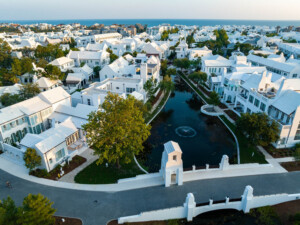
Alys Beach began design in 2003 as a labor of love by EBSCO’s cofounder, Elton Bryson Stephens, Sr., who bought the land in the late 1970s and named the future community after his wife, Alys. The area, known locally as 30A after the scenic highway running through it, and its beach resort communities are a treasured destination across the Southeast, with increasing recognition in other regions. Most homes in Alys Beach started as vacation homes, but post-COVID, many homeowners took up year-round residence.

Alys Beach stands out for its award-winning New Urbanist design, created by some of the founders of New Urbanism itself—DPZ CoDesign, the firm established by Andres Duany and Elizabeth Plater-Zyberk, in collaboration with and carefully maintained by town architects Marieanne Khoury-Vogt and Erik Vogt, who have added their own flair and influences from Moorish, Greek, and other vernaculars.

As Galina Tachieva, managing partner at DPZ explains, Alys Beach was informed by the earlier, nearby DPZ projects of Seaside (already famous by the time) and Rosemary Beach, and can be understood as a third generation of sustainable and resilient developments that prioritize compact, walkable, pedestrian-scaled communities filled with open spaces and public gathering areas in the style of older, pre-automobile cities around the world. “The compactness of these communities is the number one condition for being environmentally responsible, because then you can leave nature alone,” she notes.

Storm resilience was also an obvious necessity, given the location and the community’s origins. “The Stephens family was committed to this as a legacy project and was not going to take shortcuts, and understood the need to invest on the front end,” according to Khoury-Vogt. Developer and designer visions aligned, and when DPZ was brought in, “it became really important that sustainability was  considered on all aspects of the project from the horizontal infrastructure to the vertical infrastructure.”

As described by Allan Barnes, president of Apex Engineering Group, every structure is designed to withstand wind speeds over 160 miles per hour, or a Category 5 hurricane and an F3 tornado. Homes near the water are built to the ASCE/SEI Standard 24-14, Flood Resistant Design and Construction, and the guidelines of FEMA P-550, Recommended Residential Construction for Coastal Areas: Building on Strong and Safe Foundations, using deep pile foundations and site walls that can endure wave impacts, scour, and erosion. All told, the site is prepared to experience “extreme storm event-related erosion and scour” and “the dynamic wave set-up and surge elevation of a 100-year storm event.”

Climate Resilience and Sustainability Strategies

Alys Beach uses a combination of green infrastructure/site strategies and building strategies to achieve a resilient design that responds to its main risks of hurricane winds and extreme heat, and in extraordinary cases, storm surge.

Alys Beach is located roughly 30 feet above sea level behind preserved natural dunes, which protect the community from storm surge. The community continually replenishes the dunes to maintain them as an important coastal habitat and resilience measure. Courtesy of Alys Beach.

Grade elevation and access

“We’re lucky here that we have a natural elevation that’s about 30 feet above the water, so we’re relatively inoculated against floods,” says Khoury-Vogt.

Preserved natural features

The master plan preserved the site’s original coastal dunes as the first line of defense, as well as 20 acres of existing wetlands on the opposite, inland end. The community regularly replenishes these dunes to ensure they remain functional for aesthetics and protection.

Green infrastructure and landscape features, and natural drainage system

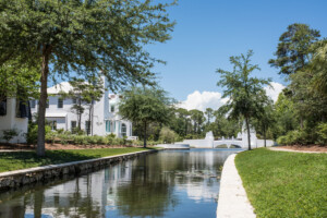
In addition to these preserved natural features, designed green infrastructure permeates the entire site. All pavement is permeable, and the underground stormwater management system treats all on-site runoff, preserving local water quality and reducing maintenance. The design carefully spread an interconnected collection of smaller detention and retention strategies throughout, from small ponds and bioswales to vegetative buffers and rain gardens.

The site’s natural drainage system replicates historical hydrological pathways. Courtesy of Alys Beach.

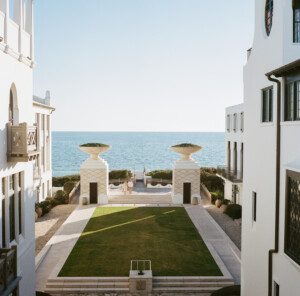
This design precludes the need for large detention ponds and creates a natural drainage system, mimicking the site’s predevelopment hydrological pathways, allowing storm and floodwater to move in and out much as it would naturally. The main streets are perpendicular to the beach, preserving all sight lines and providing storm surge a safe way to drain out of the community.

All homes are required to manage their stormwater discharge on site before it enters the community stormwater system, reducing its burden and the likelihood of flooding in Alys Beach and nearby. Only native plants, shrubs, and trees are used, which are suited to the stormy region and require far less irrigation and maintenance than conventional lawns.

Wind-resistant construction

The site’s need for storm resilience led to selection of the FORTIFIED for Safer Living® program, which every structure in the community is required to build to. The program builds on decades of IBHS research on wind vulnerabilities and exceeds the already-strict Florida and South Florida building codes, but wasn’t far out of reach based on the initial design vision.

“One key decision that was made early on for the architecture at Alys were shallow eaves, a huge plus in terms of the potential wind uplift, and the use of concrete tiles on the roof and a five-part system on top to weigh it down. Between that, the impact-resistant doors and windows, and the reinforced masonry block being the essential building block for Alys, we were 90 percent there in terms of adhering to those standards,” notes Khoury-Vogt.

The system effectively reduces the potential for wind damage by tightly fastening the entire building structure—foundations to walls to roofs—together to provide a continuous path for wind forces to follow, eventually transferring safely into the ground.

Impact-resistant, hardened materials

Hardened materials, such as concrete masonry units or cast-in-place concrete walls and concrete roof tiles, play a huge role (though all that concrete does increase the project’s embodied carbon). Khoury-Vogt says, “You can shoot a two-by-four at 150 miles an hour and you’re not going to penetrate your building envelope.”

Cool surfaces and heat-prepared exterior

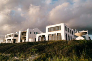
The all-white coating on every structure reflects solar heat, keeping building interiors and the neighborhood cooler while evoking traditional settlements in hot places, such as Santorini or Tangier. The masonry construction also has high thermal mass, helping it absorb heat and keep indoor temperatures down.

Strategic building orientation and density

Importantly, in addition to concentrating buildings on the site to preserve natural features, Tachieva says, “the streets are perpendicular to the beach, which invites natural breezes up along every street and deep into the site,” keeping the entire community cooler. “This was a technique not used before Seaside, and later Rosemary Beach and Alys Beach—it was either townhouses or concrete towers and slabs parallel to the beach, to have the most views, but blocking everyone in the back.”

Streets run perpendicular to the water throughout the community, allowing natural breezes to circulate, permitting stormwater to drain out naturally, and preserving Gulf Coast views for all residents. Courtesy of Alys Beach.

Thermal comfort is paramount, and the aesthetics are inseparable from climate-smart design. For example, DPZ brought the patio house style from Antigua Guatemala as the basic home typology to mass the home around lot edges, creating beautiful and “very occupiable” internal courtyards, as Erik Vogt describes.

Open-air courtyards in the center of homes and blocks, a design not common in the United States, keep homes cool and provide a sheltered outdoor space. They have become one of the most treasured aspects of life in Alys Beach, helping support strong property values. Courtesy of Alys Beach.

These are shaded but ventilated, and protected from storm winds and waves by reinforced walls. Common versions of these courtyards are also found at the center of many blocks. The patio or courtyard design is more common outside the United States, but Vogt says residents “. . . have really grown to love it. Now that’s become the most important part of the design for most of our clients.”

Low-carbon design

Though it does so quietly, Alys Beach has also emphasized low-carbon design. Vehicle parking is minimal and concentrated at the edges of the development, and extensive trails, smaller buildings, narrower street widths, and public greens make walking the most pleasant option. As Tachieva notes, this approach built on the early success of Seaside, where residents used their cars six to eight times per week, compared to six to eight times per day in nearby conventional developments. The nearly car-free environment not only supports the resort feel, but also reduces vehicle heat, transportation carbon emissions, and air pollution.

Buildings are tightly insulated and carefully ventilated, and use low-E windows. Designers also took the important step of sealing and insulating the attic, reducing heat gain. The white roofs also reduce energy consumption for air conditioning significantly.

Some homes even have solar panels and geothermal heating and cooling systems installed that further reduce carbon emissions.

As Vogt puts it, “What’s grown in importance, as much as the resiliency of construction, is the resource efficiency over the course of Alys’s lifetime, as the public’s understanding of climate change has grown. People appreciate that now almost as much as the durability.”


Value Proposition

Enhanced property value

First and foremost, Alys Beach has achieved some of the highest property values and sales prices in the state. Tachieva explains, “Per square foot, they are close to Manhattan prices, which is quite unusual for lots which are 20 to 24 feet wide by 60 feet long. These are multimillion dollar houses.”

Tess Howard, vice president of community and development planning at Alys Beach, agrees, and credits the FORTIFIED certification as helping secure the premiums needed: “Building in the FORTIFIED standard and the additional certifications helped to establish that level of quality so that we could demand the prices necessary to make the project come to fruition.”

Marketing advantage

The peace of mind provided by the exacting standards is also critical for boosting marketing and sales, and Howard explains that Alys Beach attributes its steady sales prices and volume in part to the quality of construction and FORTIFIED standard, and their ability to assure owners that their sizable investment will be protected.

Though the aesthetics and lifestyle attractions are top of mind for potential buyers, according to Diana Lane, director of public relations at Alys Beach, buyers’ interest and confidence grows after learning they won’t suddenly need to rush to board up their homes before a storm thanks to the property’s resilience features.

Reduced insurance premiums

Alys Beach’s design has also secured owners lower insurance premiums, an outcome that shouldn’t be underestimated given the increasing insurance crisis in Florida and other high-risk areas. “The insurance market for condos, is really, really intense,” says Howard. “The good thing is you know all of our condos are developed really responsibly, so when we are getting those milestone inspection reports and reserve studies done, we are faring well on the contributions recommended.”

However, she and Khoury-Vogt note insurance premiums have still increased tremendously and believe they should be lower, given Alys’s performance against storms.

Avoided losses

Alys Beach should also see far greater avoided losses and lower repair and replacement costs. Alys’s designers intended it to last for centuries, and that means avoiding the unsustainably expensive and disruptive cycle of destruction and rebuilding that has come to define life in many coastal communities.


 Lessons Learned

  • Consistency is key. To maintain community protection and its reputation for safety, each and every building needs to meet the high standards it relies on. The town architect, onsite general contractor, and approved builders are key to carrying forward both the strong design vision and excellence in resilience.
  • A good pilot can make the business case. Though being an early adopter comes with challenges, Alys Beach’s success as the world’s first FORTIFIED-certified community showed the value of that program locally and built an attractive set of returns for other developers to take note.
  • Resilience and aesthetics work better together. Many who work on Alys feel that the design lent itself well to a resilient product, while serving as a major value add. The all-white look is iconic, the vernacular architecture is dreamy but functional, the masonry is durable and lends a premium feel, and the courtyards and green infrastructure add extensive amenities and provide climate benefits.

Governors Island


Context

Located in New York Harbor between the boroughs of Manhattan and Brooklyn, Governors Island had a military presence from the late 1700s until 1996, for the U.S. Army and the Coast Guard. In 2003, the island came under control of the city and state of New York. Redevelopment commenced in 2010 when design firm West 8 won an international competition and presented the resulting Governors Island Park and Public Space Master Plan. Construction on a 40-acre (16.2 ha) public park began in 2012 and the park opened in 2016.

With over 1 million annual visitors, Governors Island consists of the park—which includes lawns, playgrounds, sports fields, food vendors, and a series of earthwork hills (the Hills) that provide panoramic views of the harbor and surrounding skylines—and education, nonprofit, and commercial facilities. In partnership with local organizations, Governors Island is intended to engage, excite, and educate the public in every aspect of urban agriculture, green infrastructure, and sustainability.

New York City’s average sea levels have risen by more than one foot (0.3 m) over the past century, a number that is double the global average. This, coupled with the reality of intensifying storms and floods, made prioritizing resilience to floods and extreme weather events top of mind for the redevelopment team. From the outset, the team saw it vital to embed climate resilience goals into all design and planning considerations. Many features of the park’s design address the impacts of climate change, including raising the site out of the 100-year floodplain, implementing a sustainable planting strategy, and mitigating wave action.

The park led to the creation of 40 acres (16.2 ha) of new public open space and the preservation of much more while making the area and its active and passive recreation choices accessible to millions of New Yorkers, many of whom lack access to high-quality park space. Combined with the park’s resilience measures, its focus on holistic sustainability is especially important for equitable open space access amid the climate crisis, given the proximity to low-lying areas in Manhattan and Brooklyn that will rely on Governors Island for park access and recreation.

Resilience and Sustainability Strategies

Resilient and sustainable design strategies are central to Governors Island, especially since it is poised to become a demonstration site to showcase new ways of developing and implementing climate resilience measures.

While the Hills on the island’s southern portion are the most visible icon of its resilient design approach, all of the park’s new landscapes incorporate native or locally adapted species chosen for their tolerance to salt and increasing temperatures as well as root structures that can reduce erosion.

Just five months after work began at Governors Island, Hurricane Sandy hit the park in 2012, putting its design strategies to the test. Although still under construction, the park sustained almost no damage. The park’s climate resilience and sustainability strategies include the following:

  • Addressing flooding and sea-level rise: To protect the island from sea-level rise, the site was raised based on flood data projections for 2100. On the island’s western side, the existing seawall was replaced with a riprap revetment to provide stronger protection from wave action by dissipating the energy of waves. The white seat edges/park benches found throughout the park offer a dual purpose for visitors to relax and protect the Hills against wave action during storm surges.
  • Stormwater management: The original site had over 19 acres (7.7 ha) of impermeable paved surfaces, creating excess runoff into the New York Harbor and hindering effective stormwater management. Addressing this, the park’s redesign team replaced those impermeable surfaces with plantings, lawn, and permeable paving to improve the island’s stormwater absorption capability.
  • Mitigating extreme heat and the urban heat island effect: The New York City Department of Health estimates that, on average, 370 people suffer heat-related deaths per year in the city. Responding to this alarming figure, the park seeks to boost nature-based solutions to mitigate heat in a city well known as a concrete jungle. With the removal of impervious asphalt and prioritizing green infrastructure, the park’s native and locally adapted shrubs, trees, and plantings help reduce the urban heat island effect and mitigate extreme heat.
  • Enhancing biodiversity: The park’s raised landscape lifts new trees and shrubs out of the flood zone, vital for the long-term survival of plants in floods. New plants at the park include 1,500 new trees at Hammock Grove and 860 new trees and 41,000 shrubs at the Hills. The park’s plantings and placements were carefully thought out to ensure their long-term viability. For example, grasses able to withstand brackish water were placed on lower-lying areas of the park while other plantings were chosen based on their tolerance to salt and future higher temperatures.
  • Supporting urban agriculture and access to fresh foods: Governors Island hosts the GrowNYC Teaching Garden, a one-acre (0.4 ha) urban farm that aims to engage and educate visitors in all aspects of urban farming. The farm’s yields of vegetables, fruits, and herbs are donated to a food pantry that distributes fresh foods in Brownsville and East New York. With the garden open to the public in the spring and summer months, residents and visitors can cultivate their sense of environmental stewardship by expanding their knowledge on urban farming and the benefits of green infrastructure in an experiential way. During COVID-19, the garden pivoted from initial plans to focus on producing hundreds of pounds of fresh produce each week to neighborhood groups giving out food to residents in need.
  • Community engagement and equitable park access: Between 2008 and 2010, the broader New York City community was engaged through surveys, exhibits, tours, presentations, and meetings to help envision the redevelopment of the island. To this day, the Trust for Governors Island continues community engagement as it plans for future phases of development and transformation. To ensure that the park is accessible to all, Governors Island has partnered with various agencies to offer free ferry rides to many visitors, including residents of New York City Housing Authority housing, seniors, children, current and former military servicemembers, and anyone with an IDNYC (a municipal identification card for New York City residents). The island’s enhanced accessibility efforts have proved valuable. In 2020, 40 percent of all visitors accessed the island at no cost, and overall, 99 percent of all New York City zip codes are represented in annual visitors to the island. The creation and preservation of high-quality open space for recreation, leisure, social gatherings, public events, and educational purposes continue to help draw an estimated 1 million visitors each year.

Value Proposition

Added amenity. While the island’s northern, elevated side long housed a military base and a coast guard, the southern side was largely neglected after being created by dumping landfill material from the Lexington Avenue subway line in 1905. Today, the completed Hills is a series of raised landscapes providing a series of defenses against future floods and rising sea levels without the use of seawalls. Visitors can enjoy the island’s entire 2.2-mile (3.5 km) promenade with the opening of the Hills and the popular Picnic Point. Prior, the southern portions of the promenade and Picnic Point had been closed since 2012. These new amenities, designed with coastal and flood resilience in mind, offer new opportunities for recreation and play.

Increased developable land. Anticipating future real estate opportunities and the value of mixed-use development, the island designated 33 acres (13.3 ha) on its southern side for future real estate. The island’s Historic District also hosts over 40 existing buildings available for reuse and leasing. To bring Governors Island’s commitment to sustainable and resilient design to life, plans are underway to establish the Center for Climate Solutions. The center will act as a hub that brings together interdisciplinary research focused on developing, testing, and scaling new tools for climate solutions with meaningful public engagement through educational and cultural experiences. The forward-thinking approach to resilience strategies coupled with this new center ensures that the park and the island not only will survive many future climate threats, but also will help create even better climate solutions for an ever-evolving crisis.

Lessons Learned

  • Co-benefits for people and the planet: Governors Island demonstrates how resilient design strategies can create a host of co-benefits for people and the planet. Features like the wave-mitigating park benches and the raised Hills serve both human and climate adaptation needs—for rest and recreation, and protection against sea-level rise and extreme weather events, respectively. These design features highlight the interconnectedness of human experiences in parks and the preservation of open space to help future-proof natural hazards.
  • Ensuring equitable access: A successful park fosters inclusivity and prioritizes access for low-income communities of color that are unevenly affected by a lack of green space access. Governors Island addresses an important disparity in park and green space access by offering free admission, free ferry rides from Manhattan to the island, and free public programming to engage the community at large.
  • Persistent care and programming: Beyond Governors Island staff members and volunteers who provide ongoing stewardship, the park’s robust, year-round programming draws visitors to engage with the space in hands-on ways. The park serves as a venue for a variety of local organizations and offers events that provide environmental education and an appreciation for arts and culture. A small sampling of community events includes ice carving, jazz shows, wildlife walking tours, pop-up markets, and nature painting.

Church Creek Flood Storage and Resiliency Project

The Church Creek Basin drains nearly 5,000 acres along the Ashley River and is home to dense residential neighborhoods. In 2015, a 1,000-year flood drenched the area, and the city of Charleston initiated a FEMA-funded buyout of almost 50 homeowners in Bridge Pointe neighborhood, within the Church Creek Basin, which has repeatedly flooded since development of the area boomed in the mid-1970s.  

Because of settlement patterns, land use, and discharge needs in the area, the city of Charleston embarked on the Church Creek Flood Storage and Resiliency Project “to lower flood risk and enhance post-event resiliency while ensuring the vitality and viability of the area.”   

The project is the product of a larger planning initiative, called the Dutch Dialogues, that started in 2017 to arm the city with innovative strategies and tools to combat rising waters and flooding in the Lowcountry. City government leaders obtained support for this project, which would harness insight from thought leaders from the Netherlands and other international experts, through an initiative started by the Dutch Embassy and funded by the Historic Charleston Foundation, the city of Charleston, and other local partners. Through this collaborative effort with the city and these global experts in planning, stormwater management, and climate resilience, the initiative established a city vision based on a new approach to thinking about the interconnectedness of water, land, and people, and their benefits to one another.  

Matt Fountain, the director of stormwater management for Charleston, called this collaborative process the “Dutch approach.” Fountain supervises a large part of the floodplain buyouts in the Bridge Pointe neighborhood, which includes 32 condominiums and nine townhouses that are all contiguous.  

Five-and-a-half years after the receipt of the FEMA Flood Mitigation grant, Fountain is overseeing the construction of public space on the bought-out sites, whose impact may ripple through property values throughout the Church Creek Basin. The new five-acre, $1 million public space will include recreational and water management features and is being funded by the city’s drainage fund and two National Fish and Wildlife Foundation (NFWF) grants.   

The project team, including conservation planning, ecological restoration, and design firm Biohabitats, engineers Weston & Sampson, landscape architects Surculus, wetlands habitat conservation and mitigation firm Wildlands, and public benefit conservation corporation Resilient Land Matters, are working on establishing a forest and wetland restoration projects on a total 20 acres of the basin. Construction is likely to begin by 2022. The Church Creek Basin resilience project will also include an ecological park for residents and tourists.   

The project embodies the design approach that came from the Dutch Dialogues, in that the city is using the water to its advantage. “We’re trying to convert this into some kind of passive recreation space, with water storage and space for native habitat including bald eagles,” Fountain said.  

With additional NFWF grants for design and management of the park site totaling $1.625 million, city leaders have been trying to upend traditional thinking about development. Rather than seeking an “ever-bigger pipe” to discharge inescapable floods, Fountain’s team aims to create parks and drainage sites that fortify the waterfront city’s natural appeal. As a result of this focus on waterlines and topography, Fountain says, “what would be a secondary benefit for someone else’s project is a primary benefit for us.” The grant is being used to construct rain gardens, protected wetlands, and other green infrastructure improvements on the lots where the homes were bought out and demolished in 2019. 

His team also aims to increase resident knowledge about how to manage water on site. A group called the Ashley-Cooper Consortium has joined the city in running workshops to help residents perform their own “green infrastructure” maintenance with cisterns and other fixes. Faith leaders have also done much outreach on this initiative to homeowners associations, Fountain said. “We talk a lot at the city about trying to make this one project that does lots and lots of things.” Using this program of work to educate the community on green infrastructure benefits and maintenance is a co-benefit to the city.  

The Church Creek Flood Storage and Resiliency Project plan hinges on recalculating the site’s value—not just for salability, but for floodwater storage. In taking land off the market, though, the team also recognizes the risk of upward pressure on prices in neighborhoods and on traffic throughout the city. “Development pressure is intense, and affordability is fragile,” says Fountain. He estimates the city will spend between $12 million and $15 million on property buyouts and the retrofits of these properties in flood storage. This includes the acquisition of between 50 and 60 moderate-income housing units in a city of 150,000 people. With those economics, storage value needs to translate to more traditional forms of value while offering multiple benefits.  

Exploring the frontier means new collaboration across communities and government agencies. The collaboration plays out in new policy, like the city’s Stormwater Design Standards Manual, which reflects debate among homeowners associations, engineers, scientists, and others who treasure Charleston for its kinship with the coast.  

“We see projects that emphasize rebuilding with resiliency,” Fountain says, “as a leveraged opportunity to send people back out into the market.”   

The Charleston Stormwater Design Standards Manual, updated in 2020, has key principles that include mimicking natural systems, designing for larger precipitation rates and future sea-level rise projections, incentivizing green infrastructure, and adding special rules for flood-prone areas. The manual translates stormwater design strategies into criteria required for permitting. For the city’s own projects, they must also score adequately on cost/benefit analysis, biodiversity, operations, and physical safety in a new stormwater project prioritization system the city developed with infrastructure consulting firm AECOM.  

Takeaways: 

Think beyond typical jurisdictions and borders for creating funding sources and innovative collaboration opportunitiesThe city of Charleston found a key funding partner in NFWF, which typically focuses on national parks but also offers grant programs with an urban/suburban environmental focus. City planners also gained tremendous value from Dutch Dialogues, a program which offered international insight and expertise and brought together a number of local stakeholders in the process. 

Take a “living with water” approach. Unlike other cities explored during research, Charleston did not solely predicate its Church Creek Basin buyouts on the impetus to stop repeated flood-damage claims. The Church Creek resilience project aimed to recharacterize a neighborhood in harm’s way as something harmonious with rising seas by changing land use patterns and investing in green infrastructure that would manage future flooding.  

Derive value from design. The Dutch Dialogues and stormwater guidelines have found their way into city contracts, documents, and formal policy. The Stormwater Design Standards Manual is used on all new private and public development and redevelopment projects in the city, while the design principles created the metrics for the city’s new quadruple-bottom-line stormwater project prioritization system.

Charlotte-Mecklenburg Floodplain Buyout Program

Historically, Charlotte developed significantly before floodplains were mapped. Therefore, some building took place in zones where flooding along creeks was more likely, said Tim Trautman, the flood mitigation program manager for Charlotte-Mecklenburg Storm Water Services (CMSWS).

“We considered various structural approaches to reduce flood damage, but we came to the realization that because of where our floodplains are, it was time to start un-developing.” —Tim Trautman, flood mitigation program manager, Charlotte-Mecklenburg Storm Water Services

Since 1999, Storm Water Services has purchased more than 450 flood-prone homes, apartment buildings, and businesses throughout the Charlotte-Mecklenburg region. The website touts their success: “Over 700 families and businesses have moved to less vulnerable locations outside of local floodplains. 185 acres of public open space has been ‘undeveloped’ to allow the floodplain to function during heavy rain and provide a long-term community asset. Storm Water Services also estimates these buyouts have avoided $25 million in losses and will ultimately avoid over $300 million in future losses.”

The utility’s authority, says Trautman, comes wrapped in compassion, and the decisions his team encourages appeal to long-term health, safety, and quality of life. Successful buyouts, backed with the county’s available cash from stormwater fees, can save property owners from physical and emotional loss. They also save the county from water rescues, overtime hours, shelter opening, temporary housing, and nail-biting unknowns that come from heavy storms. “Charlotte-Mecklenburg floodplains have a lot of urban flash flooding,” Trautman explained. “They require quick action and emergency response.”

In that context, Trautman nonetheless stresses the value of planning buyouts holistically, in accord with other public interests and benefits, such as local parks which usually maintain the purchased properties and planning staff who stitch them into the city’s fabric. Their buyouts do not end with the demolition of buildings. The property is put to greater public use, so the benefits extend beyond flood mitigation. “Even if floods come without much warning,” he adds, “flood buyout programs benefit from steady funding and consistent vision. The most successful programs are really ongoing as programs, backed by a long-term risk reduction plan.” Trautman said his team makes comprehensive plans for coordinating buyouts and flood-prevention projects in a few neighborhoods per year.

Growth brings more capital to the stormwater fee pool but also puts strain on stormwater systems even through Charlotte-Mecklenburg ordinances require substantial stormwater detention and treatment. Assessments of a property’s impervious area is the basis of collection of stormwater fees, which grow into a pool that Trautman’s team can dip into for buyouts. He notes, “Many communities solely rely on federal disaster money, and they sometimes wait one to two years after the event to apply.” Trautman points to CMSWS’s funding stream and specifically a “rainy day fund” as a way to speed up the process. “By contrast, we’ve closed on flood-damaged homes within a couple months of a flood and recently were able to buy a bank-owned distressed property about five weeks after bidding on it.”

That mix of quick turnaround closing and long-range focus matters, because Trautman says prices have climbed with flood risk caused by climate change in just the past five years. Trautman says the footprint of properties that the team can target has grown even though local prices for buildings, flood-prone or otherwise, have tended to climb even through the COVID-19 shutdown. “It’s a seller’s market, for sure,” he says. With ample capital, the utility can think about long-term benefits for the community as well as fair prices for each owner with whom the team negotiates.

Not every owner perceives the future flood risk in the same way. Trautman says roughly 75 percent of sellers respond positively to the idea of escaping flood risk, but every owner has a different perception of a fair price. “Balancing our need to increase community resilience with the need to keep the program voluntary is our number-one challenge,” he reflected. One response to the challenge comes from making sure that planning and buyouts occur in sync, so that relocated homeowners and other neighbors get to enjoy the new open space along the creeks.

Because of the voluntary nature of buyouts, coming up with plans that create public amenities and meet homeowners’ needs on relatively short notice is challenging. “It’s not like planning a highway, which takes years, and the land acquisition is a certainty.” So the team focuses on purchasing parcels over time and as opportunities arise that can add up to corridors—“one was pictured as a future greenway”—that attract stormwater and attract neighbors on the preponderance of days when most people need not think about floods.

The evolution from susceptible house to sustainable open space/park offers many opportunities for the county, Trautman added. His team and staff from partner agencies may also look at how a post-COVID city uses purchased land. Various master planning groups on which Trautman serves may reassess how the county values bike lanes, public space, and wider sidewalks, given the need for and use of these public spaces during the pandemic. With the real estate market “squeezed,” in his words, water-related disasters can stray from owners’ minds. However, his team continues to advance this work. Focusing on developing relationships with flood-prone property owners and strategizing about long-term uses of the properties could create amenities that also manage flooding. “The biggest thing is developing that relationship and trust with people,” says Trautman. “That leads to having them feel good about what government is doing.”

For example, the Doral apartment complex, which included 260 apartments on 19 acres, flooded six times since 1995, with damages topping $8 million. Charlotte-Mecklenburg Storm Water Services purchased the complex for $4.7 million, leveraging a FEMA grant for 75 percent of the project cost and CMSWS fees for the remaining 25 percent. By October 2010, all the units were purchased, and eligible residents were given relocation assistance. Across Briar Creek, CMSWS also purchased all 196 units in the Cavalier Apartments (13 acres) using the same FEMA grant/stormwater fee funding approach. With a combined 28 acres of land along the creek, CMSWS worked with the parks department and other government agencies to restore a large green space, now known as the Chantilly Ecological Sanctuary.

As a result of these buyouts, more than 700 residents have been relocated out of hazardous areas with high flood risk, and much of the land has been restored in various forms of open space, some parks and trails, that also mitigates future flood damage to the area.

Takeaways

Include each parcel in a plan. Successful flood buyouts not only offer a market price but also offer a vision of a more enjoyable city with hardier and easier-to-reach green space. CMSWS collaborates with city agencies on a comprehensive plan every five years, which details linear parks that can emerge from purchased vulnerable properties.

Bring the backing of your jurisdiction. As a county utility, CMSWS carries the value of the assets it purchases. It also brings consistent capital to buyout negotiations each year on the strength of its annual assessments. (If impervious surface decreases and brings assessed valuation down with it, the county would still draw on a dedicated funding source rather than relying on protracted FEMA payments.)

Connect with other agencies whose mission serves the resilient city. While each place evolves its own flood maps, Trautman ascribes some of his agency’s appeal to its coherence with the city’s neighborhoods. Focusing on creating parks, corridors, and—potentially—inclusive public life, the agency can present itself less as a collector of parcels and more as a creator of places.

New Jersey Blue Acres Buyout Program

The Blue Acres Buyout Program, as it is formally known, seeks to improve the slow approval times that keep homeowners from collecting disaster relief and the tortuous process of finding replacement homes. The program has impressive metrics that show its success. Since Superstorm Sandy, the program has secured federal funding for nearly 1,200 properties and made offers on 1,115 of them. To date, about 700 homes in 20 municipalities and 10 counties have been demolished, creating open space to provide a buffer against future floods, and an asset for recreation and environmental rehabilitation.

The floodplain buyout program was amplified after Superstorm Sandy, in which dozens lost their lives, 365,000 homes were damaged or destroyed, and $30 billion in economic loss was wrought across the state, said Fawn McGee, director of the Blue Acres Program and bureau chief for the Green Acres State Land Acquisition Program, at a ULI 2020 Fall Meeting concurrent session. Before Sandy, local governments struggled to process more than $100 million in pre-Sandy flood insurance claims so the state stepped in to help the municipalities with buyout projects that could mitigate future risk and losses, and most importantly help their residents move to safer ground.

Blue Acres, McGee laid out, focuses on “getting families out of harm’s way.” The buyout process is voluntary, and homeowners must apply for a buyout to be considered. Flood-prone areas with clusters of interested homeowners, in areas with local municipal support for buyouts, may be eligible for a possible buyout project. The program is funded by federal sources like FEMA and HUD. However, through a constitutional amendment by the New Jersey State Legislature in 2019, a portion of the state’s corporate business tax is also used to fund the program to ensure a more sustainable and predictable funding approach.

“One of the hardest parts of the buyout process is convincing the governing body of a community,” McGee said. “These communities are looking at every dollar associated with every home that we remove, and the biggest hurdle is getting that community and its government to realize that [what we are proposing] is the best solution.” McGee’s team must complete benefit/cost analyses for each home appraised over roughly $275,000 to qualify for FEMA grants. The team must also caucus with homeowners who need those grants and need a stable place to live. McGee emphasizes providing respect, continuity, and clarity to those homeowners.

She says the process comes in two steps: bringing local governing bodies on board and then working with residents. Evaluating possible buyouts with local governments flows from maps, photos, and discussions about their unique current and future challenges and goals. “When you look at the cycle of recovery in that one low, wet corner of the community, the governing body eventually realizes that those tax dollars could be going to enhance a healthier community for all residents. Almost immediately, I’ve had mayors say: this is great! We’re going to break even almost as soon as we close out, because of the emergency costs.”

Once mayors (who are especially numerous in this home-rule state) agree, McGee says, the Blue Acres professionals act as “advocates” for families. They use prestorm market valuations and require the appraisers to meet with the homeowners and consider the property owner’s prestorm photos of their homes, such as photos of their home “after a celebration,” to ensure the appraisers get a sense of the prestorm condition of the home. There is no transfer fee, real estate tax, or realtor fee for property sellers.

“As soon as we have the grant approval, we have a private meeting [between the Blue Acres team and participating homeowners], and we have police at the door [of the facility to help manage attendance],” McGee told the ULI group. “Staff are ready within days of the evening kickoff meeting to get out on the property, so the people can see that their government works.”

“I will meet with someone at their kitchen table or in a diner, and my appraiser will show them the comps so they can walk around the neighborhood and see how their value was determined. Our staff is always on call, and once the families are ready to accept our offer, we go to contract.”

McGee says the program has consistently earned public funding. “As the most densely populated state, we’ll hit carrying capacity around 2050,” McGee said. “Voters want to have a park that they can walk to with their families, and they want clean air and clean water.” The Blue Acres program is a part of the New Jersey Department of Environmental Protection’s Green Acres Program (60th anniversary this year!) and is designed to work in concert with the initiatives and procedures set forth through the Green Acres Program’s Bureau of State Land Acquisitions, where McGee also serves as bureau chief. The Blue Acres program acquires flood-prone properties that will, similar to the Green Acres Program’s acquisitions, then become preserved open green space, expanded passive recreation areas, and enhanced flood hazard mitigation, in perpetuity.

One example of the Blue Acres Buyout Program’s success came after Hurricane Sandy in the city of Linden. The Blue Acres program purchased 22 flood-prone properties within the waterfront Tremley Point neighborhood and partnered with the city, nearby university, local businesses, engineering and construction firms, as well as other government agencies to preserve the area as open space for recreation and floodplain restoration. The project was recognized for its success through the New Jersey American Water Resources Association Excellence in Water Resources Protection and Planning Award and a Bowman’s Hill Wildlife Preserve 2021 Land Ethics Award.

The Blue Acres program is also noteworthy because of its role supporting tenant relocation. A requirement under HUD’s Community Development Block Grant Disaster Recovery program is to help relocate tenants affected by the buyout of their rental property and pay for a comparable living arrangement. In order to support renters and landlords more quickly, a tenant relocation program with a dedicated team was added to the Blue Acres purview in 2017. Since then, over $1.2 million in relocation assistance has been distributed and 51 households have been assisted, two of which became homeowners.

McGee attributes success to compassionate staff and “being good listeners.” It is important that team members understand that this is emotional and traumatic—the flood events, the history in their homes, putting their faith in a government program, and moving: “Nobody wants to leave their home and folks don’t necessarily trust the government.” In addition to the one-on-one attention provided to each family, McGee continued, GIS mapping of flooded areas can often help the homeowners see the storm’s effect on the home and neighborhood. A picture is worth a thousand words.

Anticipation and preparedness are part of the plan McGee sets for her team. The team tries to stay ahead of the seller’s schedule, so that when the seller has a need or a question, or is ready to move forward, the team is able to step in and help. Hurrying potential sellers, however, does harm. “I had a family who wanted to wait to move until June because their son was the quarterback of the football team.” she said. “And the answer was, like, of course!”

Takeaways:

Staff up to earn trust and to deliver services and support. “My folks all have phones and access to cars,” McGee said, stressing that homeowners must be able to expect a near-concierge level of service. That includes driving to meetings on evenings and Saturdays. Critically, it includes due diligence that creates a longer-than-forecast list of properties to purchase, in case sellers drop out of the program.

Consider buyout areas that consist of clusters or contiguous parcels to maintain the fabric of the community and leave the potential for the community to use these areas for future passive recreation and conservation amenities. The Blue Acres program considers the properties acquired through the buyout program as an opportunity to create a buffer that protects upland areas from future flooding, as well as land that can continue to provide value by creating passive recreation and conservation spaces for the public. McGee says mayors and taxpayers who get the math of replacing a ratable with a townwide attraction become cooperative quickly and for the long term.

Finch Cambridge

Homeowner’s Rehab Inc. (HRI), a nonprofit, community-based affordable housing developer, saw Finch Cambridge as an opportunity to expand its commitment to healthy and sustainable housing. The area around Finch Cambridge has historically been dominated by commercial and light industrial uses. However, rapidly increasing market-rate residential development in the neighborhood inspired HRI and city staff to pursue development of an affordable rental project, meeting the area’s urgent need for more affordable housing options.

The development team was committed from the beginning to climate resilience and minimal environmental impact. The Finch Cambridge site was previously occupied by a gas station, then was vacant or underused for several years. Though the site is not in a current flood zone, potential flood risk exists because of the large amount of impervious surface as the neighborhood develops, as well as nearby freshwater sources.

The development team also assessed the local risks of extreme heat and the potential for associated power outages and loss of air conditioning. “There’s a high need for cooling as well as heating, and the cooling need has been increasing in New England,” says project architect Michelle Apigian, associate at ICON Architecture. Cambridge’s Climate Change Vulnerability Assessment report documents that the frequency and duration of heat waves are projected to increase, with as many as 68 days per year registering temperatures over 90oF by 2070.

“Passive House design is great for urban resilience because residents can stay in the building if there’s power loss and no air conditioning.”—Jane Carbone, Director of Development, HRI

HRI originally planned to develop Finch Cambridge “to meet the more energy-efficient and robust stretch code,” says Jane Carbone, director of development for HRI. Cambridge also has sustainability guidelines requiring Leadership in Energy and Environment Design (LEED) Gold for new construction. However, HRI secured a waiver to pursue Enterprise Green Community (EGC) recognition instead because the EGC’s focus on multifamily and resident health better aligned with the project and the organization’s mission.

The city of Cambridge, MassHousing, TD Bank, and the Massachusetts Housing Investment Corporation (MHIC) are the project funders. The early sustainability focus allowed HRI to secure an additional $147,000 in grant funding from the Massachusetts Clean Energy Center (MassCEC) and MassSave by expanding the project goals to include Passive Building certification as part of a state pilot program. Certified Passive Buildings are recognized for achieving quantifiable and rigorous standards for energy efficiency and indoor comfort.

Climate Resilience Strategies

The lobby at Finch Cambridge provides at-grade accessible entry while also limiting flood risk, sitting nearly 18 inches above the projected 2070 floodplain. In addition, no residential units are located on the ground floor, thereby minimizing the exposure of residents to floodwaters in the event of a major storm. In fact, the residential portion of the building is another five-and-and-a-half feet higher in elevation above the floodplain. The building’s mechanical equipment is also raised: some is located on the roof and some on the second floor. For the ground floor, the development team also chose materials such as durable ceramic tile flooring, dry wall, and metal accents that are unlikely to sustain significant water or mold damage if there is significant flooding.

Finch Cambridge has significant engineering elements to address stormwater, including an 8,000-gallon on-site tank (a requirement by Cambridge) to collect stormwater runoff. In addition, a CULTEC system collects stormwater from the roof and directs it to pipes on the perimeter of the property where it is held until it can dissipate as groundwater after a storm.

The strong stormwater infrastructure is “another deterrent to stop potential flood issues at the building” if there is a major storm, says Carbone. The system also allows Finch Cambridge to manage stormwater on site and not add to the city system during times when demand increases.

The six-story steel-and-wood-frame structure has an airtight building envelope composed of a three-layer air barrier, with additional air sealing at each opening such as windows, doors, and duct penetrations. Finch Cambridge also has fiberglass insulation in the wall cavities as well as a two-inch layer of continuous exterior mineral wool, made in part from recycled materials, to limit thermal bridging.

To address extreme heat risk, triple-glazed windows bring in ample light and cross-ventilation, and shades on the southern face of the building reduce overheating from solar heat gain in the warmer months. A 105-kilowatt solar photovoltaic array on the roof provides about 20 percent of the building’s electricity. Finch Cambridge also has a community space on the sixth floor that is linked to a generator capable of powering air conditioning, giving residents a place to comfortably shelter in the event of a power outage. The roofline, evocative of the wings of a bird in flight, provides important shade and a creative cue that inspired the team to rename the development “Finch.”

“We’re seeing a huge push for Passive building design in the market for affordable housing and for housing in general. . . . It just makes sense. We’ve all seen the advantages of it . . . and the state rebates are giving it traction, too.”—Matthew Smyka, Project Executive, NEI General Construction

Around the building, a portion of the hardscape is porous pavement that helps manage stormwater and works with drought-tolerant vegetation. Large trees also provide shade to residents.

Finch Cambridge is adjacent to a fresh-pond reservoir and has an on-site pocket park with a walking path for wellness, an outdoor patio at the building entrance, an outdoor dog run, covered and secure bike storage, and a free weekly farmers market. Another health and sustainability measure was eliminating carpeting, removing a source of allergens for residents and ultimately reducing landfill waste.

Business Outcomes and Lessons Learned

Finch Cambridge has been successful in terms of project cost, resilience paybacks, high tenant demand, and industry recognition. The building has earned Passive House, Enterprise Green Community, and FitWel certifications. Demand at Finch Cambridge has been very strong: the development attracted 2,600 applicants to a lottery for the 98 available units. The building is fully affordable at low-, moderate-, and middle-income levels.

“The costs of achieving all of the Passive House requirements were below 3 percent of total project cost,” says Carbone, and the additional grant money from MassCEC offset the extra expense. Much of the price premium over baseline code requirements was related to the high-performance building envelope, including air-tight and thermal continuity and thermally broken and gasketed windows, says Apigian.

The team managed costs and performance by keeping some spaces, such as the large lobby, outside the pressurized boundary, whereas all residential units remain inside it. Careful modeling of energy use and right-sizing of heating, ventilation, and air conditioning choices, including efficient electric heat pumps, give the building a projected energy use intensity (EUI) of 23, which is about 70 percent less than average and contributes to making Finch Cambridge one of the most operationally energy-efficient buildings in Massachusetts.

Though a small additional cost is involved in bringing fresh air to every room, that engineering decision has health benefits that are especially important because of the COVID-19 pandemic that was active at the time of resident move-in. The continuous, balanced ventilation and careful compartmentalization of space, as required by the Passive House standard, will help reduce the spread of germs between residential units, Apigian says.

Regarding the resilience measures, “there are some initial costs in terms of infrastructure, but the benefits far outweigh the issues,” Carbone says. “If you have an incident, the cost to remediate the building and just get it back to the way it was can be significant with insurance claims, bringing in subcontractors to demolish damaged materials, and reinstallations. There’s also the potential for time lost and resident impacts if families have to relocate. The benefits of making the building more resilient just far outweigh the costs.”

HRI estimates that the airtight building envelope and passive cooling systems will allow residents to remain comfortably in their units for several days in the event of a power outage during a heat wave.

The project partners agree that buy-in, close coordination, and thorough understanding of the project’s resilience and energy efficiency goals were key to implementing the details necessary to achieve the Passive House certification. “Passive House is all about being proactive with the architect during design and construction, and working through details,” says Matthew Smyka, project executive at NEI General Construction.

In addition to weekly owner/architect/contractor (OAC) meetings, NEI and the subcontractors held regular preconstruction coordination meetings and separate Passive House meetings to review the plans and specifications that were part of the upcoming phase, says Smyka. The extra coordination paid off: the construction team provided solutions to minimize thermal bridging along the edges of the building slab and on the steel components of the building and underground garage.

In terms of next steps, HRI plans to learn from Finch Cambridge by tracking a wealth of energy, water, and wellness data, especially on indoor air quality; the data will also be shared with residents and other stakeholders. HRI looks forward to sharing Passive House and Enterprise Green Community lessons learned with the affordable housing development community.

Bayshore Villas

Hurricane Maria gnawed through Puerto Rico’s streets, homes, and power lines, leaving more than half the island without electricity for months. Yet it caused just a pause in lease-up and construction at Bayshore Villas. Puerto Ricans spread the word that this complex stood up to the storm: after the lights came back on across the island, 2,400 families had applied for one of the only 40 market-rate apartments. Today, as recent earthquakes challenge local resilience planning, other developers have started assembling financing for projects that follow Bayshore Villas’ lead.

How does such success occur? The answer starts with the experience brought to the project by McCormack Baron Salazar. Richard Baron cofounded the firm in St. Louis in 1973; earlier, he had represented tenants of that city’s failed Pruitt-Igoe public housing complex. When the firm began operations, it raised capital for core-city developments as polished and aesthetically consistent as luxury townhouses. The firm proved time and again that good design and strong property management could foster vibrant places where people of different incomes enjoy living together. As those complexes recouped their investment, the firm spread its footprint. It became a premier firm for delivering mixed-income housing, which earned it an invitation to Puerto Rico.

Adapting its approach through strategic local partnerships earned the firm the trust it needed in a new kind of low-rise market. In San Juan, the firm’s leaders, as they always do, selected a well-known and respected local architecture firm, then worked closely with that firm to make the project a template for hurricane-ready construction. That firm was Álvarez-Díaz & Villalón, which has offices in Miami and San Juan.

The architecture and development plans yielded a resilient but welcoming complex. The site’s underground storm chambers detain over 70,000 gallons of stormwater, so heavy rains cause less damage. The electricity loads of the common areas are offset by a solar photovoltaic system through net metering, and those loads can be met by backup generators for several days after a power outage. The development also has impact-resistant windows and doors, and reinforced concrete is used in the exterior structures. As a result, the entire system resists windborne debris, hurricane-force winds, and the intense fluctuations in air pressure a storm can bring.

Lead architect Ricardo Álvarez-Díaz, cofounder and chief executive officer of Álvarez-Díaz & Villalón, says early discussions led to power-supply strategies and use of storm-resistant materials. “We always knew that a disaster may happen,” he says. “A resilient and sustainable approach was introduced as a way to create value and provide innovative, transformative, and socially responsible solutions that lead to the betterment of the community. This has to be the norm for us to adapt, endure, and thrive as a society.”

This approach made good economic and social sense to McCormack Baron Salazar as well. “Lower-income residents are the least able to recover, financially, from the negative impact of a storm,” says Cady Seabaugh, vice president of communications and sustainability at McCormack Baron Salazar. “We knew we had to make the property hurricane resilient for several reasons, the most important of which was to help our lower-income residents continue to move up the economic ladder. Not only does the resilient design protect the private and public investment in the property, but also it protects the residents and families the property is meant to serve.”

The buildings and grounds survived Hurricane Maria with materials equal to the storm. The construction process also survived a supply crunch for building materials through a common effort by the builder, the design team members, and the Puerto Rico Department of Housing.

The design aspects applied at Bayshore Villas help it serve San Juan residents in all circumstances—fitting the mission that led the Department of Housing to select McCormack Baron Salazar in 2013.

The good faith among leaders at the Department of Housing, indeed, set Bayshore Villas in motion years before Maria hit the island. In 2013, reformist officials in Puerto Rico resolved to replace inward-facing public housing towers near the waterfront with mixed-income apartments that encourage residents to mingle in public spaces. Such design approaches fostering interaction can build familiarity and trust among residents, encouraging them to support each other during extreme events—a key aspect of community resilience.

Even before the storm, the apartments entered uncharted territory. The apartments would mainly serve low-income neighbors, but 22 percent of the units would be rented at market rates. This concept would require a new way of thinking and a new type of project approach for Puerto Rico. That conviction led consultants at the Department of Housing to contact McCormack Baron Salazar president Vincent Bennett. For the firm, the opportunity to bid for the San Juan project presented a challenge: it would have to take an approach to the site as exacting as it ever had, but in a breathtaking waterfront setting near some of San Juan’s toniest homes—and on a site that doubtlessly would face storm surge.

As Bennett recalls, other than the tropical trees, the Old San Juan sites resembled the scarred neighborhoods his firm had helped heal elsewhere. “Secretary of Housing Alberto Lastra and his successor Fernando Gil were very interested, as was HUD [the U.S. Department of Housing and Urban Development], in breaking the psychological barrier that prevented families of different incomes living side by side in the same building.” McCormack Baron Salazar’s team proceeded with confidence that Lastra, who trained as an architect, understood how urban design in an Instagram-worthy location would create market-rate demand.

In part, the government preferred a mixed-income model to replace public housing because federal subsidies for public housing had shrunk and would dwindle more in future years. Officials needed market-rate rents to help subsidize low-income apartments—and they needed a project that would thrive on its own. “Initially this meant many meetings with high-level department directors, midlevel directors, and resident leaders,” recalls Bennett. “We were sharing a lot of collateral material from other cities—case studies and designs. It was an intensive, intentional effort at chipping away at skepticism.”

Skepticism began to fade when McCormack Baron empowered Álvarez-Díaz & Villalón to lead the design team’s outreach efforts. Architect Álvarez-Díaz, who worked for years in New York before opening his own firm, quickly moved from sharing drawings to visiting with local residents in order to sharpen the project’s details.

As he recalls, the team succeeded in crafting a workable budget and specifying an outward-looking design for two reasons: members worked with the Department of Housing to navigate administrative barriers, and they huddled with residents to build trust. “At our firm, we always design projects that include sustainability and resiliency measures from the implementation phase for the building, site, and surroundings,” says Álvarez-Díaz. “This is not just for a specific project, but for all. This is not an afterthought or a reaction to current trends, but part of the responsibilities in our holistic approach.”

From his San Juan office, Álvarez-Díaz recalls how he had seen Miguel Hernandez Vivoni, Lastra’s predecessor, sit with public-housing residents and hear their fears about daily crime in the dark, boxy towers where they lived. That outreach, he says, helped residents express design priorities for Bayshore Villas and a companion project called Renaissance Square. The government’s support for the outreach then showed that the Department of Housing would work with him and his client to foster a close-knit and walkable community.

“Both the Puerto Rico Department of Housing and the regional HUD office were willing to work with the rules toward a goal in which we were not simply building housing but building community,” says Álvarez-Díaz.

The project mixed Álvarez-Díaz’s local knowledge of site planning, architectural design, local culture, and materials with McCormack Baron Salazar’s expertise in financing, community transformation, and overall development. Bayshore Villas, like McCormack Baron Salazar’s successes in St. Louis, Atlanta, and elsewhere, is oriented toward the street. The 12 buildings that make up Bayshore Villas top out at four stories. Windows greet the public paths and the waterfront. The unit mix fits within uniform building shapes and efficient use of space, but with variations in the exterior treatment. This approach restated development theses McCormack Baron Salazar had convincingly pursued in former industrial cities. Adapting it to this context, says Bennett, meant learning new design strategies.

In response to input from local experts, the team constructed winding paths and large plazas as places for gathering. For the design elements that would attract families from all walks of life, the teams pooled their knowledge. Álvarez-Díaz led a planning session with neighbors of the site, and the developers brought the architects to tour sites in Florida and St. Louis that had grown with financing structures similar to that of Bayshore Villas. “The design team led us in sitting down and having a good exchange with local contractors around what’s worked well on the island,” Bennett says.

Bayshore Villas echoes communities McCormack Baron had built in colder climates but does not copy them. “We learned the importance of trade winds in how you orient buildings to take advantage of air circulation,” Bennett says. “This is especially important after storm events so residents can open their windows when there is no AC, but is also part of the culture of the community.”

Nothing on the construction drawings or spec sheets changed after the storm, according to Bennett and Álvarez-Díaz. “The only items we’re looking to add are backup generators, which we initially limited to common buildings due to budget,” says Bennett. Looking ahead, he adds, the team wants to write scenario plans to help tenants get medicine and air conditioning if power again goes down for several days. Looking back, the main challenges involved cutting checks to contractors due to delays in insurance payouts and keeping connected with former residents, he says.

The mixed-income model survived Maria as visibly as the structures do. Bennett says his firm kept faith with the model by declining to revise the waiting list to let market-rate tenants bid up available apartments. “The underwriting specified what we could charge, and that was appropriate,” Bennett says. “We had a waiting list and no interest in gouging.”

Now that affluent San Juan residents have shown interest in mixed-income living, other local developers have started building competitive projects. If those competitors want to see complex projects through Maria’s certain sequels, their teams might draw inspiration from these lessons.

Lessons Learned

Create construction plans and budgets that assume a storm will strike—and arrange financing with the assumption that insurance will not pay you back. Insurance reimbursements remained slow or were missing as the developers went through the final punch list and lease-up. Governments, even cooperative ones, cannot cover losses at this scale. Bennett suggests building a budget around grants and forgivable loans, and with money from investors in tax-credit schemes, to help ensure that contractors and professionals can go back to earning paychecks before insurers pay out on developers’ claims (or if they never do).

Build trust with civic leaders to safeguard your return on investment. The slow approvals and construction process produced a consistent design and marketing budget because community leaders had weighed in on the project, says Álvarez-Díaz, and because they felt free to keep speaking up as the project took shape. McCormack Baron Salazar’s clear signal that local authorities could steer the development process made for willing partners in government and the outreach that Álvarez-Díaz conducted made the property attractive. After the shock of Hurricane Maria, this confidence paid off in steady leasing.

Master local history and share your own history. Stories had been swirling for years in San Juan about a government willing to invest in mixed-income designs, according to Álvarez-Díaz. When Bennett chose Álvarez-Díaz’s firm, McCormack Baron Salazar gained access to stories and priorities from residents who had tentatively started trusting the redevelopment process several years earlier. Likewise, Álvarez-Díaz & Villalón prepared drawings for Bennett with the knowledge that the client had delivered and sustained mixed-income successors to poverty-trap projects in cities across the United States. Because the developer and designer both gained reasons for confidence in their vision, design work proceeded to include ambitious sustainable elements like solar panels. It also proceeded despite the storm.

Trust in a local partner. Álvarez-Díaz salutes McCormack Baron Salazar for growing fluent in San Juan’s culture. “When I say culture, I don’t mean music and dance,” Álvarez-Díaz says. “I mean political culture.” Bennett and his staff had met and spoken regularly with regulators during the years it spent revising its request for qualifications and completing its budget. They knew both how the Department of Housing had explored community-based design ideas and how partisans had let old models persist after they had lost favor elsewhere in the United States. That knowledge gave Bennett license to call and re-call officials when they needed funds and crews after Hurricane Maria.

Bagby Street

Bagby Street, originally a four-lane throughway, is located in a tax increment reinvestment zone in Midtown Houston, a central neighborhood just south of the downtown core that has experienced significant growth since the early 2010s.

With that growth and increased demand on public infrastructure and utilities, the Bagby Street corridor was in need of major repairs and upgrades, especially to its stormwater infrastructure. “We saw it as an opportunity,” says Marlon Marshall, director of engineering and construction for the Midtown Redevelopment Authority (MRA), “to develop a sustainable capital improvement project to try to induce additional development in this area.”

Mitigating the urban heat island to ensure pedestrian comfort was a central design strategy; hot temperatures in Houston are a concern from May to October. The project team, led by Walter P Moore, also wanted to improve stormwater management to be prepared for Houston’s occasional heavy rains and hurricanes.

Before the reconstruction, 10 of Bagby Street’s 13 sidewalk blocks were in disrepair, and commuters used it primarily as a cut-through to reach two nearby highways. In addition, Bagby Street required significant drainage and utility updates, and averaged a summer surface temperature of 108°F.

Bagby Street has been reconstructed to provide more public space, attract development, and remain comfortable, walkable, and usable during times of extreme heat and flooding.

Extreme Heat Resilience Strategies

To meet the Midtown Redevelopment Authority’s goals, Walter P Moore and landscape architect and urban planning firm Design Workshop proposed reducing Bagby Street from four lanes to two, incorporating pedestrian safety features and adding significant green infrastructure. “We were able to improve levels of service even though we reduced the number of lanes,” explains Edwin Friedrichs, senior principal at Walter P Moore, “because with two lanes, it was much faster to walk across the street. We could give more through time on the roadway.” Less traffic also meant less waste heat production from cars idling at traffic signals or in traffic.

With reduced traffic delays and car idling, there is reduced emissions and waste heat.—Jennifer Peek, Executive Director, Infrastructure Group at Walter P Moore

Downsizing the road also allowed for a 38 percent increase in seating and social gathering space, which has contributed to “increased pedestrian activity,” says Marshall. To support the increased pedestrian traffic, the project team used heat-resistant paving materials and landscaping to maintain a comfortable environment. The team selected pavers with a high solar reflectance value and 25 percent recycled material content. “The pavers cost about double what concrete would generally cost,” says Alex Ramirez, associate at Design Workshop, “but they contribute to the branding and identity the Midtown District desired.”

The team also deliberately decided against brick pavers to minimize erosion and maintenance costs. According to Friedrichs: “We are experiencing more rainfall events with four to six inches of precipitation in just a few hours. That running water washes the sand out of brick pavers, which then need to be repaired.”

We put Bagby Street on a ‘road diet’ and gave a bunch of space back to the public.—Alex Ramirez, Associate, Design Workshop

The extra social space allowed the addition of 175 new, large shade trees along the corridor, which would also reduce temperatures and improve the pedestrian environment. The redesign also included rain gardens with heat- and drought-tolerant plant species and aligned new permanent irrigation infrastructure with a small park adjacent to the street.

When some property owners along Bagby Street initially opposed the removal of short, non-native tree species to make way for larger, native trees, the project team led a significant and successful community engagement effort. “We held meetings with every property owner to show what was going on through construction, what the completed project would look like next to their property, and to explain the benefits of low-impact development and trees,” says Friedrichs.

Outcome 

The corridor’s new design has significantly improved local business, the pedestrian experience, and environmental outcomes, earning its place as the first Greenroads-certified project in Texas and the highest-scoring Greenroads project for several years until 2017, when the Sellwood Bridge in Oregon surpassed Bagby Street by one point in the rating system.

Bagby Street has also received recognition from the American Society of Landscape Architects, the American Council of Engineering Companies, and the Congress for the New Urbanism. One lesson learned from the certifications and awards processes is to document all the activities related to the rating system in order to achieve full credit, advises Jennifer Peek, executive director of the infrastructure group at Walter P Moore.

Moreover, “we’ve shown that green infrastructure can be beneficial from a dollars-and-cents standpoint,” says Marshall. In the first year after the reconstruction, nearly $30 million in private development was invested along Bagby Street. Property values along the street have increased 25 percent and 20 percent for the rental market. “Abandoned parcels were redeveloped into bars and restaurants,” says Ramirez.

Bagby Street has become a significant node of attractive establishments. It’s been very successful over the last four to five years.—Marlon Marshall, Director of Engineering and Construction, Midtown Redevelopment Authority

MRA and its partner organization, Midtown Management District, responsible for operations and maintenance, have also realized cost savings and work efficiencies from the redesign. By aligning Bagby’s irrigation infrastructure with the nearby park, for example, Midtown has seen a steady 10 percent water bill reduction every year since the reconstruction.

In addition to installing new heat-mitigation features and additional stormwater infrastructure, the project team and MRA coordinated with the local utility providers to replace overhead utilities on taller poles and consolidate poles on one side of the street. Those changes eliminate half the street’s overhead powerline conflicts with the big shade trees and allow the trees on the side of the street with utility lines to grow larger before needing to be trimmed, thereby reducing maintenance costs.

“Bagby has become a model project,” says Marshall. “We’ve had national visitors and presented it at many conferences as a prototype of tackling a number of aspects, including human comfort from a heat perspective.”

Design Workshop used a heat gun to measure surface temperatures at the street level; “there’s about a 20-degree Fahrenheit difference between areas where the direct sunlight is hitting pavement to pavement in the shade,” says Ramirez. The new design achieved a 42 percent increase in shade on sidewalks, allowing 90 percent total shade coverage and a 14 percent reduction in surface temperatures throughout the corridor.

The green infrastructure is also an asset during times of heavy rains and hurricanes. Since completion, Bagby has weathered three major floods, including Hurricane Harvey (2017). “While many other areas of Midtown Houston flooded,” says Marshall, “there was no flooding on Bagby Street during any of those major flood events. We’re proud of how Bagby performed.”

FORTIFIED Home Building Standards

In Alabama, hurricanes such as Ivan in 2004 and Katrina in 2005 left devastation in their wake, including homes destroyed that required billions of dollars to rebuild, as well as limited availability of and increased rates for home insurance. Since then, Alabama has been active in encouraging resilience through legislation and incentives.

One example is incentives that encourage the use of FORTIFIED Home™, a set of performance-based engineering and building standards designed to help strengthen new and existing homes through the installation of specific building upgrades that reduce damage from hurricanes, hailstorms, low-level tornados, and severe thunderstorms.

The Alabama Legislature has required insurers to offer discounts to owners of homes meeting the FORTIFIED standards, which have been proven to offer protection against wind damage. Metrics from a recent study by the Alabama Center for Insurance Information and Research (ACIIR) show additional returns on resilience: homes built to the FORTIFIED standards in two coastal Alabama counties earned a nearly 7 percent premium in resale value over those not meeting the standards.

“FORTIFIED standards [are] an economically sound investment. The additional cost of building or retrofitting is frequently less than 7 percent of home value; therefore, the benefit of FORTIFIED designation is very likely to outweigh the cost.’’—Estimating the Effect of FORTIFIED Home™ Construction on Home Resale Value

The FORTIFIED Home program was created by the Tampa, Florida–based Insurance Institute for Business & Home Safety (IBHS), an independent research and communications nonprofit organization supported by insurers and reinsurers, to promote construction and upgrading of homes for resilience to natural disasters. IBHS tests a variety of construction and retrofitting methods at its Research Center in Richburg, South Carolina, running simulations for rain, hail, wildfire, and wind speeds up to 130 miles per hour.

Licensed professionals certify homes at one of three FORTIFIED levels: Bronze, Silver, or Gold. The Bronze level focuses on roof strength and resistance to wind. Silver requires reinforcement of the roof, adding use of impact-resistant windows and doors. Gold addresses the first two levels and further requires a “continuous load path,” ensuring that buildings are adequately load-bearing and secured to the ground. Another set of FORTIFIED standards is used to protect commercial buildings and ensure continuity of operations despite hurricane, high wind, and hail.

As of November 2016, builders and owners of about 6,000 homes had applied for FORTIFIED designation, and 3,600 had been so designated across the United States, most located in the Southeast. A range of homebuilders are building to the FORTIFIED standard, including volume, custom, and modular builders.

“Resilience should be affordable for everyone,” says Julie Rochman, IBHS president and chief executive officer. “It should not just be for high-end custom builders.” FORTIFIED homes are “overwhelmingly clustered in places with financial incentives or some sort of mandate,” such as Alabama, Mississippi, North Carolina, and South Carolina, she says. Builders of new homes strive for Gold designation, she notes, whereas retrofits tend to be designated at the Bronze level.

FORTIFIED standards provide “greater assurance for homeowners that, if an extreme event occurs, they won’t have to move out for six months while they rebuild.”—ACIIR director Lars Powell

Alabama leads the nation with more than 2,500 FORTIFIED homes, and has a variety of programs incentivizing use of the standard. A 2009 Alabama law requires insurers to provide homeowners with discounts for coastal houses that are built, rebuilt, or retrofitted according to FORTIFIED standards. They now earn a discount of about 35 percent on the wind portion of their insurance premium. A state program, Strengthen Alabama Homes, provides grants for retrofitting homes to FORTIFIED standards. The “coastal code supplement” building code overlay adopted by many municipalities is also based on the FORTIFIED standard.

The FORTIFIED standard is becoming better known regionally and nationwide. For instance:

  • More than 60 chapters of Habitat for Humanity are committed to using FORTIFIED through the organization’s Habitat Strong program. The organization has tested the standard at various home price points and now builds all coastal Alabama and Mississippi homes to the FORTIFIED standard.
  • The White House Forum on Smart Finance for Disaster Resilience in 2016 highlighted the FORTIFIED standard as an example of innovation that helps reduce the loss of life and property, and which can generate value for homeowners.
  • Several federal agencies, including the Federal Emergency Management Agency, Department of Housing and Urban Development, Department of Energy, Department of Agriculture, Department of Homeland Security, and Department of Veterans Affairs, have specifically encouraged and recognized the value of FORTIFIED standards through various activities targeting stakeholders in the built environment.

Mitigating Risks

Research is demonstrating the positive impact the FORTIFIED designation has on home resale value, which could help homeowners, insurance companies, and policy makers adopt and promote resilient construction practices.

The study by ACIIR, a research center at the University of Alabama’s Culverhouse College of Commerce, examined data on the resale of homes built to the FORTIFIED standards in Mobile and Baldwin counties. Researchers studied the two Alabama counties because they have direct coastal exposure to hurricanes and the highest concentration of FORTIFIED homes in the country—a circumstance resulting from county building codes that incorporate FORTIFIED standards and insurance incentives that encourage their use.

The study, “Estimating the Effect of FORTIFIED Home™ Construction on Home Resale Value,” investigated the sales of 321 homes from 2004 to 2015, 22 percent of which were built or retrofitted according to FORTIFIED standards.

The homes were located slightly less than two miles from the coast and included residences representing the full range of the market, which has been developing rapidly in recent years with vacation and retirement homes. The houses in the sample on average were six years old and had 2,531 square feet of space on a half-acre lot, four bedrooms and two bathrooms, and a sales price of $293,000. Most of the properties in the sample had been sold within the previous three years.

Researchers used a hedonic regression model to estimate the marginal effect of FORTIFIED home construction standards on home resale value while controlling for other housing characteristics, such as lot size, building square footage, age, number of rooms and full bathrooms, fireplaces (an indication of higher-end construction), distance from the coast, and market conditions when the house was sold.

Creating Value

The study concludes: “switching from a conventional construction standard to a FORTIFIED designation increases the value of a home by nearly 7 percent, holding all other variables constant.” The findings “suggest that building FORTIFIED houses or retrofitting houses to meet FORTIFIED standards is an economically sound investment,” the report says.“The additional cost of building or retrofitting is frequently less than 7 percent of home value; therefore, the benefit of FORTIFIED designation is very likely to outweigh the cost.”

The cost of compliance with FORTIFIED standards for new homes ranges from zero to 3 percent of hard costs, according to IBHS. Building to FORTIFIED standards in jurisdictions with stricter building codes typically means that there are fewer additional costs above those for building to code, except for designation inspection and paperwork. Retrofits generally cost 18 to 24 cents per square foot.

The study shows there is a “value benefit for this type of standard being adopted” in the coastal Alabama market, says a principal researcher, Harris Hollans, associate professor of real estate at Auburn University.

In choosing between two side-by-side houses in the same subdivision, he says, homebuyers would likely find greater value in the FORTIFIED home, which is structurally more resilient and, as a result, earns a reduced insurance premium. The higher resale value is another significant reason to choose a FORTIFIED home. As the FORTIFIED standard is adopted increasingly elsewhere, says Hollans, “there’s a pretty compelling argument to be made that this would likely hold true for other parts of the country that face similar [risks].”

Yet another designation value is “greater assurance for homeowners that, if an extreme event occurs, they won’t have to move out for six months while they rebuild,” says ACIIR director Lars Powell, another principal researcher, who sees ACIIR’s research as potentially transformative for homebuyers. He notes an even greater impact would come from acceptance of the study data by mortgage appraisers, with lenders such as Freddie Mac accepting the information as a valuation factor. “That is what will make it really affect home value,” he says.

Brock Environmental Center

The Brock Environmental Center, located in Virginia Beach, Virginia, where the Chesapeake Bay meets the Atlantic Ocean, is drawing tens of thousands of visitors as one of the world’s best examples of sustainable and resilient design. This environmental center and office for the Chesapeake Bay Foundation (CBF), a leading regional environmental organization, is operating at net-zero water, waste, and energy use. The building has extremely low monthly operating costs and has raised awareness of low-impact design, helping the organization achieve its mission of protection, advocacy, education, and restoration of the bay’s environmental health.

The Brock Center is raising the bar in modeling environmentally intelligent construction and living, a CBF goal dating to its first composting toilets in the 1970s. In 2000, CBF completed a new headquarters, the Philip Merrill Environmental Center, in Annapolis, Maryland. It was the world’s first building to achieve LEED Platinum, the highest designation in the Leadership in Energy and Environmental Design rating system. Completed in April 2015, the Brock Center is CBF’s second landmark building designed and constructed in concert with its natural surroundings, with minimal impact on the surrounding land, air, and waterways.

For the Brock Center, CBF and the Washington, D.C., office of architecture firm SmithGroupJJR aimed for a newer and more rigorous sustainability standard, the Living Building Challenge, intended to encourage development with a positive, regenerative impact on the environment. Certification by the International Living Future Institute requires net-zero energy and water use and waste generation, meaning the building conserves or produces as much of those three elements as it uses. It also requires avoidance of the use of fossil fuels and 300 “red list” toxic chemicals. A building’s net-zero energy, water, and waste performance must be demonstrated for a full year of operation before certification is awarded. The $8.1 million, 10,500-square-foot center has earned both LEED Platinum and Living Building certification.

“Visitors leave with the sense that sustainability and resilience are not that hard, and you don’t have to lose comfort, beauty, or efficiency to get there.”—Mary Tod Winchester, Chesapeake Bay Foundation Vice President

Beyond the building, the project included protection of the 118-acre Pleasure House Point site, a low-lying area that was the last large undeveloped parcel in Virginia Beach and had been intended for development of 1,100 high-rise condominiums and townhouse units. The city of Virginia Beach and the Trust for Public Land worked with CBF to purchase the property after the developer defaulted on loans during the economic downturn of 2008. CBF owns ten acres, which are integrated into a public conservation park that encompasses the remaining acres owned by the city.

The center features a conference room, meeting and exhibit rooms, a catering kitchen, decks, and an education pavilion, which are often used during field education experiences, seminars, community gatherings, and corporate events. More than 40,000 people have toured the building and property since it opened.

“The center reduces pollution and gives back to the environment, which is critical for the bay, and it also is an excellent education tool that clearly demonstrates to government leaders, decision makers, architects, contractors, engineers, students, teachers, and the general public about sustainability and resilience,” says Mary Tod Winchester, CBF vice president for administration.

Mitigating Risks

The Brock Center design addresses protection against high winds, storm surge, and flooding. The building is situated 200 feet from the shoreline and elevated 14 feet above sea level on cast-in-place concrete columns and spread footings—exceeding Federal Emergency Management Agency elevation requirements for 500-year flood and sea-level-rise projections. It also is designed to withstand 130-mile-per-hour winds, exceeding local code requirements. The curved roof design and building materials contribute to wind and water resilience: durability is enforced by zinc roof shingles, deep protective overhangs, and naturally rot-resistant cypress siding.

The building works to achieve water independence by using rainwater for all water needs, including drinking. Rainwater is harvested from the roof and diverted and stored in two 1,650-gallon tanks in an insulated area beneath the building. The center is the first commercial building in the United States permitted to treat rainwater for potable uses. The water is purified with filtration, ozonation, and ultraviolet treatment.

The building also collects stormwater runoff in rain gardens that filter it before it is released back into the aquifer. Graywater from sinks and a shower also flows into rain gardens. CBF, local community groups, and the city are restoring adjacent wetlands by removing invasive species to allow native plants to naturally filter and absorb stormwater and water from sea surges.

The ability of the structure to operate as a net-zero building is enabled by highly effective energy conservation features.

The center has a 45-kilowatt solar photovoltaic array on the roof and two standalone ten-kilowatt Bergey residential wind turbines that can generate more than 100 percent of the energy the building requires to operate. The solar panels contribute about 70 percent of the building’s electricity and the wind turbines about 30 percent. The building envelope is super-insulated—walls to R-35, the floor to R-31, and the roof to R-50, more than double typical thermal resistance levels for the region. The R-7 windows are argon-gas filled and triple glazed with low-emissivity coatings. The actual energy use intensity of the building is a remarkably low 14,120 Btu per square foot per year.

“The resiliency question focused on how a susceptible site like the Brock Center can be developed to withstand flooding, hurricanes, and power outages, so that the center not only can stand, but thrive during these events, even serving as a haven for the adjacent community.”—Greg Mella, SmithGroupJRR

Creating Value

CBF does not need to purchase flood insurance because of the building’s position 14 feet above sea level and above the 500-year floodplain. It is also built to withstand high winds, so it is less likely to experience damage. Fireman’s Fund Insurance offers a discount for green-certified buildings, which generates a premium savings of about $2,200 per year.

A key resilience factor is continued safe operation of the building if an extreme weather event were to reduce access to potable water or knock out the municipal water supply or wastewater treatment system. The Brock Center’s design reduces the demand for potable water by nearly 90 percent. The building has been using a very efficient 50 gallons of water—rainwater treated to be potable—per day. With daily consumption running at about one-third of the projected 145 gallons, the building is expected to perform well even in a drought. The center also holds a supply of treated potable water capable of withstanding a six-week drought. The water supply is in a mechanical loft, meaning gravity can supply water even when there is no power.

Dealing with human waste is a huge concern during disasters. The flushless composting toilets’ holding tanks under the building have been secured to the foundation in watertight concrete vaults designed to prevent waste from escaping during a flood. Small battery backups can maintain emergency lighting, security, and a toilet exhaust system for multiple days during power outages.

Cost savings to operate the net-zero-energy building have proved to be substantial. Brock produces 83 percent more energy than it consumes in a typical year. Electricity bills average about $17 per month—basically the cost of connecting to the grid—compared with $800 to $1,000 per month for a conventional office building of similar size. The center is considering using batteries to take the Brock Center entirely off the grid.

Another benefit for the building’s 25 staff employed by CBF and a partner organization is the high level of employee wellness and productivity attributable to nontoxic materials, abundant natural light, mixed-mode ventilation, and efficient geothermal heating and cooling.

An indoor environmental quality (IEQ) assessment survey of employees, including self-ratings for productivity with follow-up measurements of selected IEQ variables, found “compelling evidence that the low-energy building provided high standards of comfort” for thermal comfort, air quality, and lighting, says study director Hyojin Kim, assistant professor at the Catholic University of America School of Architecture and Planning. The building offers employees a high level of “adaptive opportunity,” or control over their environment, with operable windows, ceiling fans, and blinds. Studies show a close relationship between high IEQ satisfaction and productivity.