Cedar Rapids River Corridor Redevelopment Plan
The Iowa flood of 2008 hit the city of Cedar Rapids on June 13, inundating 10 square miles—14 percent of the city area—and affecting over 7,000 land parcels, including more than 5,300 homes. The city lies on both banks of the Cedar River, which on that day crested at a record 31 feet. In a rapid-recovery response to $6 billion in damages, Cedar Rapids mobilized private partners, residents, and other stakeholders to address the shared goal of redevelopment along seven miles of the flood-prone riverfront, resulting in the two-phase Cedar Rapids River Corridor Redevelopment Plan—the technical Flood Management Strategy and a Framework for Neighborhood Reinvestment.
At the core of the redevelopment plan is a long-term vision for waterfront resilience that aims to simultaneously protect the community from future floods and leverage the waterfront for economic development and the social vitality of the region. To achieve these goals, intergovernmental and private partnerships were initiated, and local, state, and federal funds were leveraged to allow acquisition of 1,400 properties through floodplain buyouts.
Cultivating Community Engagement
Phase one of the redevelopment plan, the Flood Management Strategy, began in June 2008, four days after the river crested. Cedar Rapids contracted with a consultant team led by Sasaki Associates, an urban design consulting firm, which provided planning, landscape architecture, and community engagement services on both phases of the project. The city held three series of open houses, which were attended by more than 2,500 community members.
Together, the city and the Sasaki team focused on working with the community to create a road map for redeveloping the 10-square-mile Cedar Rapids River Corridor. The flood-control system was developed during this phase and served as the critical foundation of the long-term vision for the project. Rigorous community engagement practices were carried out to incorporate resident feedback on how to maximize both future flood preparedness and public green space for recreation.
Eight workshops hosted by Sasaki over the months following the flood were attended by over 1,500 community members who dedicated more than 6,000 hours to collaborating on a redevelopment strategy. “Our main goal was to make sure everyone’s voice was heard,” says Jason Hellendrung, the Sasaki team lead on the project. “We wanted to hear from everyone—to use that and shape the plan.”
The workshops employed visual preference theory, providing residents with renderings so they could visualize the future, and used benchmarking by presenting options, such as flood walls versus wide greenways that allowed wetlands and open space to absorb water. This approach led to broad support among the neighborhoods for incorporating ample recreation space into the design. “It gave them hope about the future,” says Jennifer Pratt, Cedar Rapids director of community development. “We’re not just building; we’re building back better than before.”
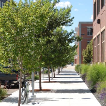
The city and consultant team took the initiative to learn from other communities that were recovering from natural disasters, such as New Orleans following Hurricane Katrina and Grand Forks, North Dakota, following the 1997 Red River flood, which provided lessons for effective communication. The time spent working with the community built trust, Hellendrung says, and ultimately led to the inspiration for the 130-acre urban greenway along the river. The river is further activated by the McGrath Amphitheater, built into the levee, which is a significant cultural anchor for the community.
“A lot of area in the neighborhood plan was not redeveloped and will be intentionally kept as open space. Letting the river breathe is a big component of resiliency for the flood-control system.”—Jennifer Pratt, director of community development, city of Cedar Rapids
Leveraging Federal Funding Mechanisms for Floodplain Buyouts
In May 2009, work on phase two, the Framework for Neighborhood Reinvestment, began as the city established a voluntary property acquisition program, leveraging U.S. Department of Housing and Urban Development (HUD) Community Development Block Grant (CDBG) Program funds.
The city offered to pay owners of the 1,356 damaged houses 107 percent of the pre-flood home value to acquire their homes. The buyouts are supported by CDBG funding after it is demonstrated that the homeowner’s pre-flood home value has decreased while the need for shelter has increased following a disaster. The city program also pledged that property taxes would not increase during the 10 years following the flood; this was done in anticipation of raising the levy later to provide revenue for the local contribution to the flood-control system.
The city also worked with the state and HUD to create an interim mortgage assistance program to subsidize the mortgage payments of homeowners affected by the flood. This program responded to the need to complement buyout programs with programs that provide relocation assistance, combat displacement, and provide affordable housing. Without relocation support, buyout programs can perpetuate segregation by facilitating the departure of lower-income homeowners from their communities because they lack the capability to buy a new house if home values have increased or are otherwise unaffordable.
The buyouts process was initiated in 2008 and completed in 2014, and in the interim, support was made available through the ROOTs Homeownership Initiative, funded by the CDBG single-family new construction program. The ROOTS initiative provided a downpayment incentive of 25 percent to qualified buyers who purchased a new home in a core neighborhood of the city, as identified in the Framework for Neighborhood Reinvestment.
 The ROOTs Homeownership initiative provided a downpayment incentive of 25 percent to qualified buyers who purchased a new home in a core city neighborhood, as identified in the Framework for Neighborhood Reinvestment. (City of Cedar Rapids)
Also, soon after the flood, the city constructed multifamily rental units designed to appeal to tenants with a mix of incomes. One thing learned from the experience of Grand Rapids was that new housing construction must be spread across a city to avoid a stigma of “flood housing” that may linger, Pratt says. The city formed the Replacement Housing Task Force to scout new construction in core neighborhoods outside the floodplain identified as ripe for development in phase two of the plan.
Beyond the riverfront, the city worked with neighborhood groups and developers to convert properties into replacement housing for residents displaced by the flood. New infill construction in surrounding neighborhoods leveraged state and federal low-income housing tax credits (LIHTC) to build replacement affordable housing. In one neighborhood, the city worked with a church-based nonprofit entity to deliver the replacement housing.
Mobilizing Local and State Economic Development Initiatives
In all, funding was leveraged at the local, state, and federal levels to fund the flood-control system. The state committed over $250 million over 20 years, and $78 million was committed by the U.S. Army Corps of Engineers for an area east of the river deemed eligible for funding. For flood control on the west side of the river, local property taxes were raised for 10 years. The city understood that it was critical for Cedar Rapids to have a plan in place and show progress on its implementation in order to encourage rebuilding and attract investment by the private sector.
The flood-control system will include the buildout of flood walls and levees intended to further protect the community from flooding. Quaker Oats Company has committed to entering a public/private partnership with the city by 2022 to build a segment of the flood wall to 100-year-flood elevation. The wall was built in accordance with city standards so it could be extended when the city builds the remaining portions. Similarly, the freight company CRST relocated its headquarters to downtown Cedar Rapids from the suburbs, built its new site along the river, elevated the property, and integrated a flood wall and river walk into the site. In this way, Quaker Oats and CRST shared with the Army Corps of Engineers part of the costs of the flood-control system and helped manage the overall budget and moderate the expense of the project for the city.
“To attract private investment, we knew we needed to have a long-term plan to protect investment,” Pratt says.